Share This Article
Did you know that there are more than 15,500 kilometres of marked hiking trails in Slovakia? Let’s take a closer look at the trail markings and their meanings.
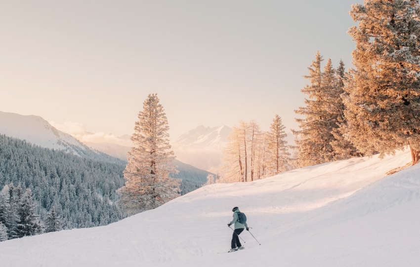
In addition to over 15,500 kilometres of marked hiking trails, Slovakia also has nearly 500 kilometres of marked ski touring routes. The Slovak Tourist Club is responsible for marking trails in Slovakia. Together with the Czech Republic, we are among the best in the world, as we have one of the most sophisticated and dense networks of hiking trail markings, not only in Europe but also globally. Do you know what each marking means and where it leads?


The basics of markings and symbols
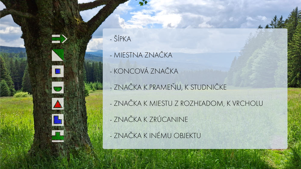
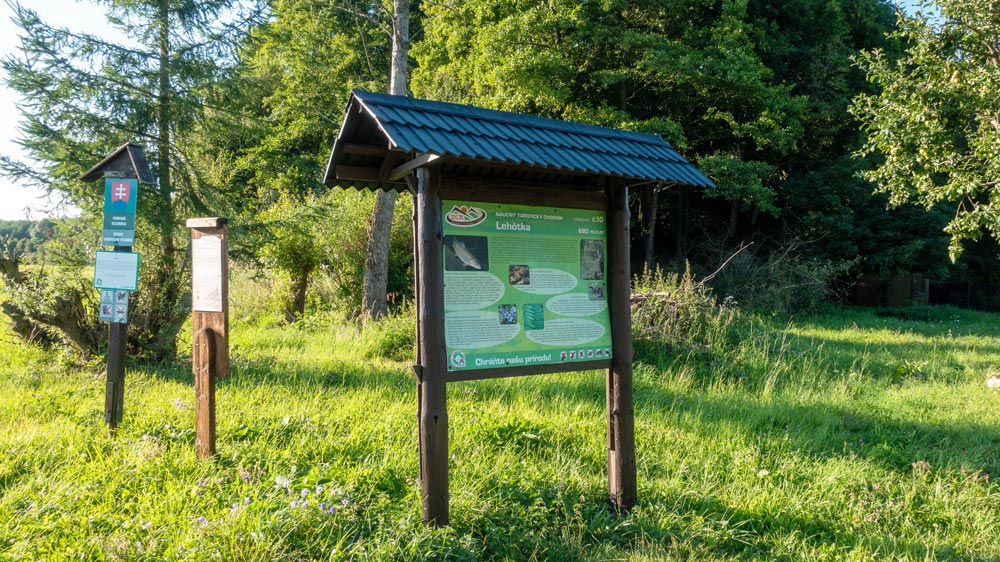
A trail marking, whether found in nature or on a map, is a symbol designed to inform hikers about the direction of the trail, distances, accessibility conditions, location descriptions and other details. Stripe markings are the most common markings used in hiking, but you may also come across arrows, terminus markers, local route markers, spring symbols, ruins and educational trails. In nature, these markings are crucial for navigation and, together with signposts and directional boards, they provide more details.
Four colours – four meanings
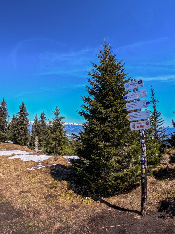
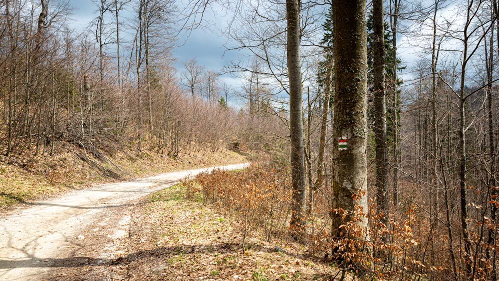
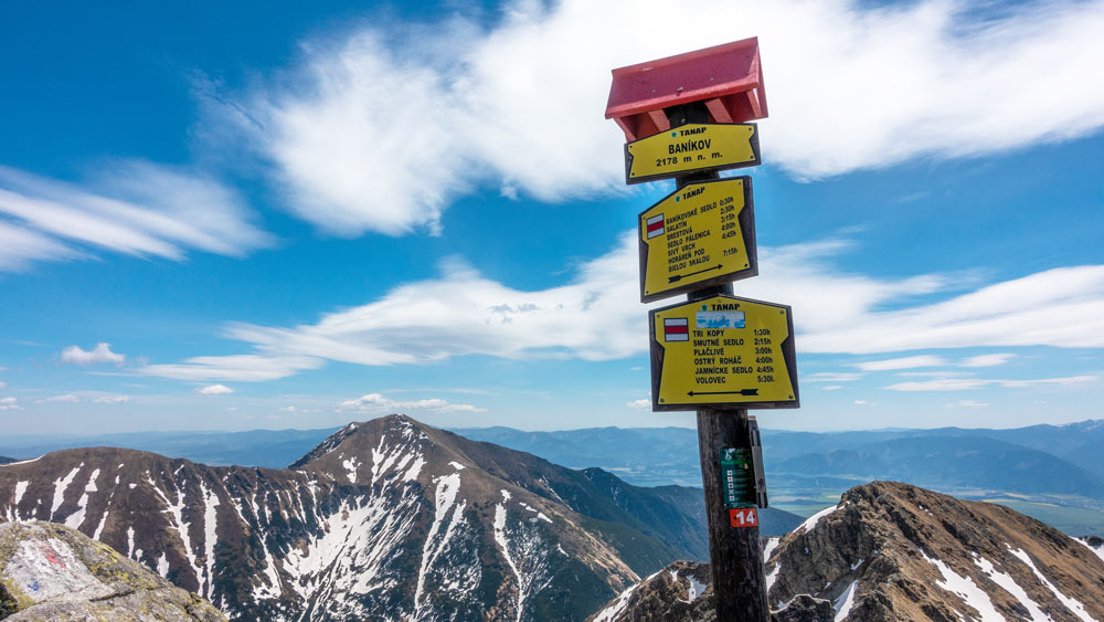
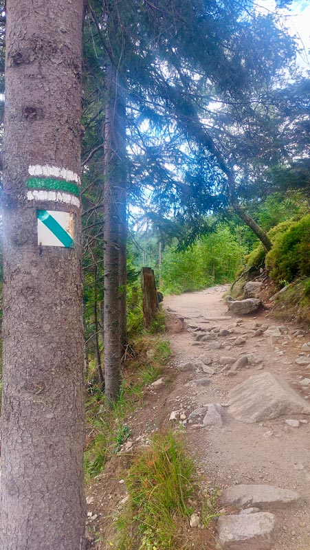
Most hiking trails in Slovakia are marked with stripe markings. They consist of three horizontal stripes, where the middle stripe changes colour depending on the significance of the trail, while the top and bottom stripes remain white to make it as visible as possible. The markings are square-shaped, usually measuring 10 x 10 centimetres. Signposts, known as “mushrooms” in the Tatras, guide hikers along these trails. The signposts not only indicate the colour of the route but also provide an estimated hiking time (in summer conditions) to the destination point.
- Red – The most important, ridge and long-distance hiking trails
- Blue – Regional hiking trails within a mountain range
- Green – Access routes, e.g. from a valley to a ridge
- Yellow – Short, simple trails connecting to major routes
Other markings in nature
Besides stripe markings which are the most common, other types of markings include arrows which indicate sharp turns and sudden changes in direction. Local route markers are used for shorter walking routes around towns, major tourist centres or campsites. Terminus markers, though less frequent, indicate the start and the end of a marked trail, as well as the end of any branch off the main route. Spring or well symbols are common, but it is important to check whether the water is safe for drinking.
In Slovak mountains, you will often find a triangle of the same colour as the respective trail, marking a route leading to a peak or a viewpoint. Other well-known markings include ruin or castle symbols which guide visitors to historical sites. Lastly, special markings indicate routes branching off to significant tourist points or locations.
Educational trails in the Low Tatras
In addition to hiking trails, there are various educational trails in Slovakia too. They are marked with a specific symbol, but continuous marking along the entire route is rare. The middle stripe of the marking is always green. Some markings include a number, indicating a stop with an interesting feature, often accompanied by an information board or details in a guidebook. A great resource for educational trails can be found on the Educational trails in Slovakia website.
Several educational trails can be found in the Low Tatras National Park as well, such as the Demänovská dolina (valley) educational trail, which starts at Mikulášska chalet and is 13 kilometres long. As you walk along this trail, you will explore Demänovská dolina and pass Vrbické pleso (tarn) to reach the upper forest boundary. The route includes several stops where you can learn about the flora and fauna of the Low Tatras, as well as the water cycle in nature. Further along, there is information about mining, shepherding and the Slovak National Uprising. The trail ends in the area of Lúčky.
Educational trails in the High Tatras
Whether you choose to spend a weekend or a week in areas such as Štrbské Pleso, Tatranská Lomnica or Hrebienok, you will find an educational trail at each of these locations. The Hrebienok education trail is one of them. It starts in Starý Smokovec, in the Hrebienok area, is 4 kilometres long and has nine stops. You can also reach Hrebienok by a funicular and buy best-priced tickets via Gopass.
This educational trail offers information about Hrebienok at the first information board. Then it runs deeper into the valley, where you can learn about the formation of the Tatra valleys. Since the High Tatras are primarily made of granite, stop 3 provides insights into this rock formation. As you continue, you will encounter further stations with information about forests, hiking trails and Studený potok (brook), until you reach Rainer’s hut. Here, you can take a break before heading to the beautiful Studený potok waterfalls. The final board explains the vegetation zones. At the end of the trail, you can refresh yourself at Hrebienok or Bilík’s chalet.
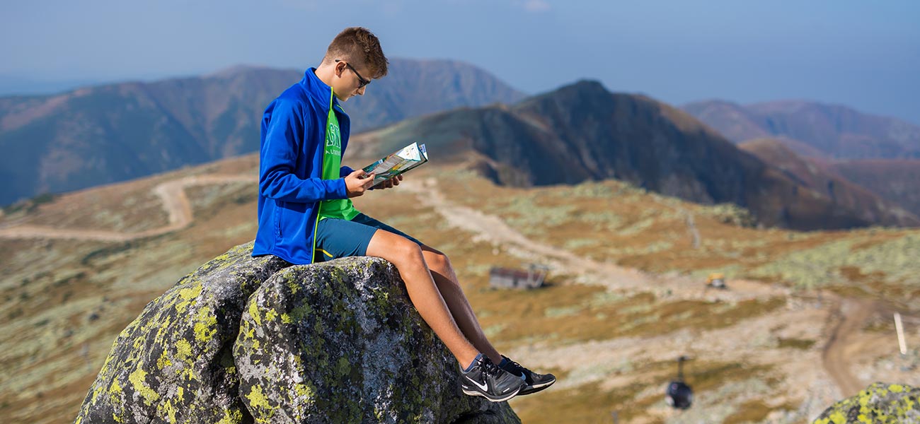
Planning your hike: Working with maps
Whether you opt for an easy hike, a high-altitude trek or an educational trail, maps are essential for planning your trip. It’s up to you if you choose between a traditional paper map or an online map available on various platforms. The legend on each map explains the markings, helping you navigate. Plan your route using the coloured trails on the map, which correspond to the stripe markings in nature, as described in the section “Four colours – four meanings.”
You can plan your trip using a paper map or an online portal such as MTHIKER, which provides information on the trail length, the altitude, the estimated hiking time and community-shared photos of the destination.
This article has been created in cooperation with MTHIKER.sk.